Recording species abundance and biodiversity

Recording species abundance and biodiversity

With species records of Somerset’s intertidal coastal zone absent for over 30 years, the Somerset Wildlife Trust seeks to update records of species abundance and biodiversity across its 53 miles of coastline.

As part of the Wildlife Trust’s Shoresearch programme, volunteer Arthur Blackwood explores questions like: what is on this coast, what isn’t on this coast, and what does this mean for the local and global environment? 

Having regularly collected data since March 2020, a team of citizen scientists from across the county has produced an extensive set of data that is continuing to grow as Shoresearch events maintain their popularity among its volunteers. These events are open to participation from anyone with any level of experience, and the dataset gathered describes the presence of over 100 species.

Understanding how these species are spread out across the Somerset coast is of huge importance in monitoring how populations change (for better or for worse) in response to threats to wildlife such as climate change, pollution, and invasive species. 

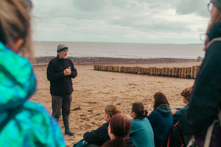
Mark Ward addressing a group of volunteers at a Shoresearch event at Dunster beach

Photo: Jon Barrett

With over 30 surveys undertaken, at the end of 2022 Somerset’s Shoresearch team decided to produce a report documenting the findings of the project so far. The report focused on 13 species that were identified as of key importance: six seaweed or algal species, six snail or gastropod species, and one invasive barnacle species. These species were recorded at 15 locations between Porlock and Clevedon. The report focusses particularly on the distribution of these species from West to East as several environmental conditions (such as nutrient levels) change as shores get closer to the Severn Estuary.

Mark Ward addressing a group of volunteers at a Shoresearch event at Dunster beach

Photo: Jon Barrett

It was found that only two of the 13 species showed a population response from West to East: the toothed and the purple topshell. The toothed topshell is of special significance as it has been suggested as an indicator of climate change within our region – more information on this is included in the report on page 18. It is amazing to think that an understanding of this species’ population in Somerset can carry implications for pressing global issues like climate change and rising sea temperatures.  

A close-up photo of thick topshells

Photo: Nigel Phillips

As part of Somerset’s Wilder Coast project, running until 2025, Shoresearch surveys continue to be scheduled regularly and are open for the public to join. As our data grows, Somerset’s Shoresearch team will produce more up-to-date reports and build upon knowledge outlined in the 2020-2022 report.

If you would like to take part in any of our Shoresearch surveys, then you can find out more information here. The data that has been gathered so far is available to whoever may wish to use it – for more information please contact mark.ward@somersetwildlife.org

Read the report