Draycott Sleights - Jeff Bevan
Draycott Sleights
Location
Know before you go
Dogs
Visit the 'Dog walking on reserves' page in the Contact section for more information.
When to visit
Opening times
Open at all timesBest time to visit
April to JulyAbout the reserve
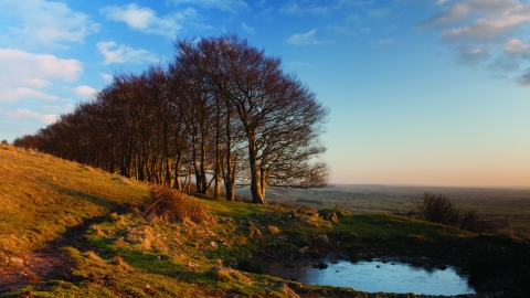
High on the southern slopes of the Mendip Hills, this special place enjoys commanding views towards Exmoor in the west and, to the north, across the Bristol Channel to South Wales. And those are by no means the only breathtaking views on offer. At ground level, some 200 species of plants have been spotted and recorded, on this steep stretch of grassland. They include more than 40 rarities, such as horseshoe vetch, pale flax, spring cinquefoil, autumn gentian, pyramidal and bee orchids – all of which provide splashes of colour to brighten this windswept, rocky landscape.
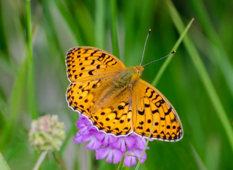
Throughout June and July, Draycott Sleights comes alive with butterflies that thrive in this kind of limestone downland, such as the Chalkhill Blue, which is best seen in July and August, plus Common and Holly Blues, while the Small Blue is seen in smaller numbers most years. Other butterfly species at the site include the Brown Argus, Grayling and Marbled White.
In the summer, Skylarks and Meadow Pipits are the most commonly seen birds on the open grassland and flocks of Linnet and Goldfinches can be seen moving through the scrub during autumn and winter. Buzzards, Kestrels, Peregrine Falcons and Sparrowhawks are among the birds of prey who hunt in the skies above the reserve, which is also home to Little and Tawny owls.
Other residents include Badgers, Foxes, Rabbits, Roe Deer and the occasional Hare, whilst Adders and Slow Worms can sometimes be seen basking on the sundrenched south west facing slopes. It is thanks to the Trust’s stewardship that Draycott Sleights remains as an outstanding example of one of the most vulnerable landscapes in the UK. Species-rich limestone grassland is very fragile and the reserve has been carefully managed by the Trust since it bought the 100 acre site in 1986. ‘Sleight’ is an old Somerset word for sheep pasture and grazing here continues as it has for hundreds of years.
History and Archaeology - Some of the land was ploughed for agriculture, notably during the Second World War, and there is evidence of small-scale quarrying and ochre pits from the early 20th century but very little has changed here for centuries.


