The grassland areas of Cheddar Wood Edge are all open access, so open to the public. Cheddar Wood itself is a permit only nature reserve, privately leased and managed by Somerset Wildlife Trust. This particular reserve is not, and never has been, an open access public site. PLEASE DO NOT TRESPASS. The only legal public access through Cheddar Wood is along the green dashed lines in the OS maps available for download below.
Purple Gromwell - Peter Baker
Cheddar Wood Edge
Know before you go
Dogs
Visit the 'Dog walking on reserves' page in the Contact section for more information.
When to visit
Opening times
Open at all timesBest time to visit
April to JulyAbout the reserve
With the coming of the Cheddar Valley railway and prior to the Second World War, several areas of woodland next to Wood Lane and Parsonage Lane were grubbed out to form strawberry fields with the produce being shipped out via the railway. Since being abandoned for growing strawberries, several have reverted to woodland while others are now being managed as grassland.
Grass species in the fields are numerous including False Oat-grass Sheep’s Fescue, Red Fescue, Yellow Oat-grass and Sweet Vernal Grass Herbs include Common Knapweed, Marjoram, Common Centaury, Field Scabious, Yellow-Wort and Meadow Vetchling.
Two Red Data Book species, the nationally rare Purple Gromwell and Starved Wood-sedge occur along the trackway leading to these fields and also on the wood edge.
Wood Lane Fields contain a greater proportion of Perennial Ryegrass and Timothy Grass. The lower Wood Lane field is extensively scrubbed over and not included within the SSSI. Lovell’s Field 4 is also excluded from the SSSI as the sward is semi-improved and the wood edge is impoverished having been shaded by Holm Oak.
Lovell’s Field 5 is a series of small old fields some of which have been heavily invaded by scrub consisting of Hawthorn, Hazel, Ash, Blackthorn, Pendunculate Oak, Field Maple and brambles. These fields are an important component of the SSSI as they provide structurally diverse vegetation including scrub and wood edge that is rarely found inside the wood itself.
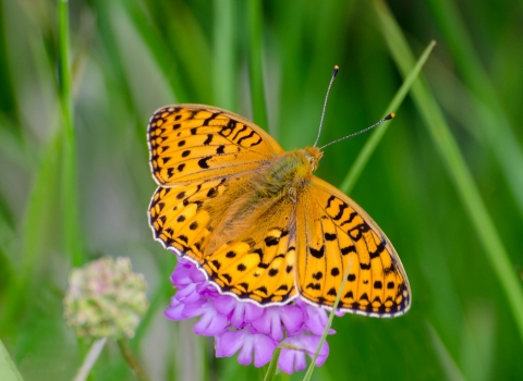
These fields provide useful nectaring areas for the woodland edge butterflies, hoverflies and other insects as well as providing habitat for numerous other invertebrate species that favour more open sites. Great Green Bush-cricket has been recorded here.
Reserve conservation management – Scrub control. Removal of non-native Holm Oak.
History and Archaeology - In the 19th century, demand for Cheddar strawberries from growing cities such as Birmingham and London became so great that a railway was built from the Yatton to Cheddar to link the village to Brunel’s mainline. It became known as ‘The Strawberry Line’. The line closed in 1964, but it has recently been transformed into a popular cycle path 'Route 26' which is part of the National Cycle Network.
Contact us
Environmental designation
Important notice
The grassland areas of Cheddar Wood Edge are all open access, so open to the public.
Cheddar Wood itself is a permit only nature reserve, privately leased and managed by Somerset Wildlife Trust. This particular reserve is not, and never has been, an open access public site. PLEASE DO NOT TRESPASS.
We have overlooked the fact that some members of the public have been accessing the site without permission, however, as this site is now greatly affected by the advanced presence of ash dieback we must insist that people do not enter the site at this time and that they only use the only legal access public footpath which is marked on the map provided through the onsite signage and below.
Ash dieback is of serious concern for public safety across our reserves and on land across the county. Whilst we will be taking down trees that are adjacent to public rights of way, it is not possible for us to fell all ash trees within the woods themselves, so it it vital that people adhere to the safety warnings on the site and do not enter the woods, where there is a very real and present risk of a fatal accident.


