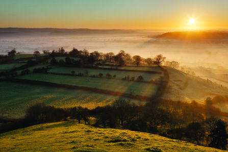
Somerset Levels. Photo: Guy Edwardes/2020VISION

Somerset Levels. Photo: Guy Edwardes/2020VISION
Land use on the Somerset Levels and Moors (SLM) is a fascinating topic for discussion. Humans have inhabited the SLM since Palaeolithic times. Throughout this 500,000 year period, the SLM has provided people with resources for food, crafting, building materials and space to live and farm. In the years following the industrial revolution, increased land use pressures and intensive management have eroded the ecosystem services the land would have naturally provided. Honeygar Farm is the start of a new era for Somerset Land use and an opportunity for the SWT to shift the focus back to recognising the importance of ecosystem services such as carbon and water storage, flood mitigation and water purification. This work will be heavily monitored enabling the SWT to learn from their journey and share the outcomes on a regional and national level.
The resources available to early humans were bountiful. Fish and wildfowl were plentiful and as sea level rise slowed 6,500 years ago, following continual rise since the end of the last ice age 10,000 years ago, reedbeds began to develop in areas of shallow water leading to the establishment of the peat-forming habitats that we recognise the SLM for to this day.
To Neolithic humans, reedbeds were an incredibly valuable resource with multiple uses. The stalks of reeds were used for thatching, the tender reed hearts were eaten providing a source of carbohydrates and the rhizomes and pollen, being high in protein, were also processed for food. humans navigated through these reedbeds by constructing wooden trackways, the most famous of which being the Sweet Track. Discovered in 1970, this structure is the oldest known timber trackway and is approximately 5,800 years old. Humans would continue to favour trackways as a means of traveling in the SLM until around 3000 years ago during the Iron Age. Due to wetter conditions, dugout canoes were the primary mode of transport during this period.
Winter flooding of the SLM was common and restricted access outside of summer months, resulting in humans inhabiting higher ground such as the Polden Hills, the Isle of Wedmore, Burtle and the Isle of Avalon. This seasonal change in land use exhibited by humans utilising the SLM persists to this day with farmers utilising land on raised ground during winter and grazing the SLM in the summer months. This has been widely suggested to give Somerset its name, derived from the Anglo-Saxon word Sumorsaete, meaning land of the summer people.
During the Roman period salt and peat works were established on the SLM, but until the Middle Ages, humans utilised the levels, but did not necessarily alter the landscape in any significant way. The Medieval period brought with it an age of organised monastic farming controlled by the church. Beginning almost 1,000 years ago, peatlands of the SLM were enclosed and drained, increasing their value to agriculture and the river Brue was re-routed to enable drainage of farmland into the system.
In the 18th and 19th centuries, land management of the SLM shifted to a much more intensive system. Advancements in engineering during this period enabled humans to drain and manage their land on a scale never seen before and the enclosure acts led to even more peatlands of the SLM being drained, for agricultural use or used for development. The intricate network of ditches, rhynes, droves and drains that are instantly recognisable as part of the Somerset landscape were created and peat, mostly for use as fuel was still being excavated.
The intensification of land use continued throughout the 20th century with even more peatlands being drained and brought into agricultural use in an effort to solve food security issues resulting from World War 2. The Huntspill River was dug to meet the high water demands of the newly built Puriton munition works and pumps were installed at Gold Corner. These two structures may have mitigated winter flooding on the SLM, but with it came a decline in water storage and fish and eel passage. In addition to this capability of water purification has also been lost, this is important as around 70% of the UK’s drinking water is sourced from peatland habitats. Somerset in the past has also been well known for its willow production for use in basketry and teazel production which was used in the textile industry. These industries showed severe declines in the 1950s and the 1980s, respectively.
Until 1980 in the UK, the ecosystem services wetland habitats can provide was not recognised or understood. Today these habitats have been identified as providing immense value to wildlife in addition to a whole range of ecosystem services such as, flood mitigation, water storage, climate adaptation, water purification and carbon sequestration.
Today the predominant land use of the SLM is dairy farming, with 70% of the land consisting of grasslands and the remaining 30% dedicated to arable crops. Lower water tables have always been favoured on agricultural land of the SLM enabling farmers to manage their land more intensively with higher stocking densities of livestock, and to grow crops such as maize. However, the most up to date science regarding peatlands shows that managing the land in this way has led to the shrinkage and degradation of peat, causing land heights to fall as much as 1 metre in the last 100 years. Peatlands, despite only covering 3% of the global land surface, store up to 30% of the worlds soil carbon and per hectare sequester more carbon than primary rainforest. Drained peatlands have been shown to emit huge quantities of greenhouse gases (GHG) such as carbon dioxide into the atmosphere. Due to current land use on the SLM it is estimated that around 300,000 tonnes of carbon is emitted each year, which equates to around 10% of all emissions for the County.

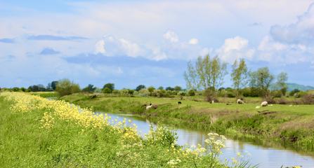
Stream near Honeygar. Photo: Kirby Everett
Honeygar Farm will enable the Somerset Wildlife Trust (SWT) to demonstrate approaches to restoring ecosystem function on lowland peat soils through reduced stocking densities and maintaining higher water tables. Honeygar is unique among the sites that SWT already manage on the SLM because it is currently of relatively poor value to wildlife. Our aim is to facilitate nature recovery at Honeygar, while monitoring water quality, GHG emissions and changes in biodiversity. This enables SWT to take an evidenced based approach to land management while illustrating how you can balance the restoration of nature with valuable ecosystem services. Overtime Honeygar will allow SWT to provide clarity and guidance to neighbouring landowners wanting to access new green financing options such as carbon and phosphate credits, while also adapting to climate change and improving the value of their land to wildlife.